Sign up to view these previously recorded virtual events to learn about new ideas for leveraging CARIS technology in your workflow.
¡Únanse a nosotros para aprender como el escáner laser es una poderosa herramienta para utilizar durante los levantamientos hidrográficos ya que nos permite capturar la información topográfica al mismo tiempo que la batimetría. En este seminario online vamos a explicar detalladamente los flujos de trabajo para adquisición de datos con el escáner laser de Teledyne Optech Polaris, utilizando el software de adquisición de datos CARIS Collect. También mostraremos en detalle el flujo de trabajo de procesamiento y análisis de la información batimétrica y topográfica con las aplicaciones CARIS HIPS and SIPS y BASE Editor.
Watch on-demandSpeakers
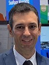 |
Juan Carballini es el Gerente de Ventas para América Latina, Mar Caribe y la Península Ibérica y trabaja en Teledyne CARIS desde el año 2009. El proporciona soluciones geoespaciales, incluyendo sistemas LiDAR y software geoespacial para mejorar la productividad en topografía, hidrografia y cartografía náutica. |
 |
José Arturo Arias es el líder del equipo de Soporte al cliente, en Fredericton, Canadá, para los productos HIPS and SIPS, Bathy DataBASE, LOTS y CARIS Onboard. Principalmente atendiendo las inquietudes y necesidades de nuestros clientes a través de la plataforma de soporte y también impartiendo capacitaciones para los programas mencionados, en diferentes partes del mundo. El ha estado con la compañía por 10 años, luego de haber prestado sus servicios como Hidrógrafo en la Marina Colombiana y haberse retirado del servicio activo en 2011, después de 21 años. |
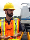 |
Gaspar Lima is the Product Manager for Terrestrial Products at Teledyne Optech and has more than 20 years in the surveying industry. Graduated in Topography in the late 90’s and later in Civil Engineering, Gaspar has focused his career on connecting the Mining & Construction industries to Geomatics applying Hi-End technology to deliver the best in class solutions. Since 2006 he has focused on the use of LiDAR and Photogrammetry to cover different applications. |
Originally recorded June 17, 2021
The hydrospatial industry is facing an ever growing demand for data and a shortage of resources to meet this increase in growth. Initiatives such as Seabed 2030 won’t be realized with current methodologies and technology, making innovation and advancement vital in achieving success. Earlier in 2021, Terratec took delivery of Teledyne Optech’s latest generation bathymetric LiDAR, the CZMIL SuperNova. This webinar will cover the leading edge advancements introduced by Teledyne Optech (including Artificial Intelligence) and how Terratec are putting these to use on projects.
Watch on-demandSpeakers
 |
Dan Kruimel, Senior Sales Manager, APAC @Teledyne Geospatial, has a vast range of international experience on hydrographic, land and aerial survey projects. Having worked over a number of disciplines for both manufacturers and consultants, he has gained exposure to a wide variety of technology and methodologies for generating geospatial data. |
 |
Charles de Jongh Sales Manager, Bathymetry @Terratec. |
Recorded October 7, 2021
Join us for an exciting look at the NEW Onboard360 featuring acquisition module CARIS Collect!
Learn how our full Ping-to-Chart solution will increase productivity from survey to data products with presentations from product management and sales experts at Teledyne CARIS.
Watch on-demandSpeakers
 |
Travis Hamilton works with the product management team at Teledyne CARIS focusing on the needs of customers in the engineering, energy and research markets. Prior to working with CARIS, Travis spent several years working with subsea mapping systems for offshore energy and academic applications. |
 |
Karen Hart is the Director of Business Development for Teledyne CARIS and Optech, applying Teledyne technology to marine and terrestrial markets. She has worked at CARIS for nearly 14 years, starting out by supporting US customers as a Senior Hydrographic Consultant and technical account manager before transitioning to the Director of CARIS USA. Prior to working for CARIS, Karen was a hydrographic surveyor and marine scientist for 7 years focusing on coastal and offshore geophysical survey. She has a Master of Science degree in Oceanography. |
 |
Geoff Dean is a geomatics professional specializing in Hydrography and GIS. With eight years experience in field Hydrography in support of Geo-technical, Environmental, and Navigation projects with emphasis on Multibeam, Sidescan, and LIDAR data acquisition and processing as well as 11 years of experience as Manager of Data Provider Affairs for the Maritime Industry team at Jeppesen. In this role he was directly responsible for the global data acquisition strategy of the business, obtaining contractual agreements with government authorities and private companies, advising on business strategy, budget planning, risk mitigation and business process improvement. Geoff also has topic specific training and knowledge in Business Management and Leadership in a Global Business Environment, Team Leadership, Contract Management, Intellectual Property, Technical Proposal Writing, and various regulatory matters pertaining to the Maritime domain. |
Recorded March 25, 2021
¡Únanse a nosotros para la presentación del NUEVO software de adquisición de datos CARIS Collect parte de CARIS Onboard360!
En este webinar podrán aprender como con el nuevo CARIS Collect pueden aumentar la productividad desde la adquisición de datos hasta la generación de productos finales con presentaciones y demos de los expertos de Teledyne CARIS.
Watch on-demandSpeakers
 |
Juan Carballini es el Gerente de Ventas para América Latina, Mar Caribe y la Península Ibérica y trabaja en Teledyne CARIS desde el año 2009. El proporciona soluciones geoespaciales, incluyendo sistemas LiDAR y software geoespacial para mejorar la productividad en topografía, hidrografia y cartografía náutica. |
 |
José Arturo Arias es el líder del equipo de Soporte al cliente, en Fredericton, Canadá, para los productos HIPS and SIPS, Bathy DataBASE, LOTS y CARIS Onboard. Principalmente atendiendo las inquietudes y necesidades de nuestros clientes a través de la plataforma de soporte y también impartiendo capacitaciones para los programas mencionados, en diferentes partes del mundo. El ha estado con la compañía por 10 años, luego de haber prestado sus servicios como Hidrógrafo en la Marina Colombiana y haberse retirado del servicio activo en 2011, después de 21 años. |
Originally recorded April 22, 2021
Exploring the use of automation in CARIS products such as CARIS Onboard, CARIS Mira AI and our cloud services in support of remote surveys.
Whether you are curious about reducing your risk profile by sending fewer people offshore, or are moving to fully robotic solutions using USVs and AUVs, there is a common need integrate modern approaches for data processing and handling to ensure you maintain control over the survey quality and platform tasking.
Watch on-demandFor several years CARIS has been building and delivering products with a focus on automation, data management, and cloud services, all of which lend well to the requirements of remote survey operations.
During the webinar we will explore the use of automation and data management in CARIS products such as CARIS Onboard, CARIS Mira AI and our cloud data services, and discuss how these products can be used to bring efficiency and comfort to remote survey operations.
Speaker
 |
Travis Hamilton works with the product management team at Teledyne CARIS focusing on the needs of customers in the engineering, energy and research markets. Prior to working with Teledyne CARIS, Travis spent several years working with subsea mapping systems for offshore energy and academic applications. |
Originally recorded April 16, 2020
Learn about strategies for transitioning your organization to S-100 using CARIS HPD.
CARIS has been involved with and supporting IHO standards for more than 30 years and has been contributing and developing S-100 related solutions since the inception of S-100. Since 2012, Teledyne CARIS has been providing the software tools needed to produce and evaluate a variety of draft specifications.
Watch on-demandSince the release in 2019 of HPD 4, CARIS users can implement and test IHO S-101 Edition 1 in their production environment without disturbing their existing production lines. This solution includes a very comprehensive automatic conversion solution from S-57 to S-101, but S-101 has potential to deliver more value than just converted S-57 data, so conversion is only an initial step towards the true value of S-101. It is, however, likely that co-production of S-57 and S-101 will be a reality for some time, and in this time the best of the two standards should be utilized (and not the least). Teledyne CARIS is offering solutions to support this reality and considering how a combination of production enhancements, automation, data restructuring and changes to production workflows will be needed to enable co-production without forcing significant additional workload on producing agencies. Teledyne CARIS is offering workshops and consulting services to help producing agencies understand and prepare for their future production needs.
As the market leader, Teledyne CARIS has a comprehensive knowledge of hydrographic offices’ workflows and is uniquely positioned to help with transitioning these workflows to S-100. This webinar will focus on describing and analyzing strategies to transition hydrographic offices to S-100 and will evaluate these strategies in terms of risks, challenges, and changeover duration.
Speakers
 |
Julien Barbeau is Product Manager at Teledyne CARIS focusing on development ideas and maintenance related to Teledyne CARIS software products, including the Hydrographic Production Database (HPD). He has been with the company for 16 years starting with providing support and training for products-related software before integrating the product management team. |
 |
Stéphane Thériault has over 30 years of work in the GIS field, including 28 years at CARIS. He participated in the successful implementations of CARIS technology in several hydrographic offices. He works as a domain expert in Hydrographic and Cartographic solutions, supervising junior staff and assisting clients. |
Originally recorded April 22, 2020
Learn about the CARIS Mira AI platform and how the new Sonar Noise Classifier can bring efficiencies to your sonar data processing pipeline.
The Teledyne CARIS team is committed to leveraging the latest technology for our customers with the creation of the CARIS Mira AI platform. CARIS Mira AI is a new cloud-based platform to host our current and future AI solutions. Backed by Amazon Web Services (AWS), offering a robust, scalable cloud platform means no additional desktop hardware is required to move users into the future of processing.
Watch on-demandWe invite you to bring the noise with the first CARIS Mira AI offering, the Sonar Noise Classifier!
CARIS seeks to significantly reduce the need for manual cleaning and move your data swiftly from acquisition to review. The Sonar Noise Classifier automatically identifies the vast majority of sonar noise, resulting in a reduction of manual cleaning effort by a factor of up to 10x at an accuracy of 95%.
AI technologies and cloud services are the new force multiplier to reduce Ping-to-Chart times. Let CARIS future-proof your processing pipeline.
Speakers
 |
Tami Francksen is the Hydrographic Product Manager at Teledyne CARIS focusing on development ideas and maintenance for HIPS and SIPS and Bathy DataBASE. She has been with the company for five years after her start as a field Hydrographer working primarily in Alaska’s Arctic region. |
 |
Burns Foster is the R&D Projects Manager at Teledyne CARIS, focusing on developing new products and services outside of CARIS' core competencies. He previously spent five years as the Product Manager for HIPS and SIPS, CARIS' flagship processing software suite. |
Originally recorded April 29, 2020
Emerging technologies, such as Artificial Intelligence and cloud-based services, have the potential to revolutionize both what we think is possible, and how we approach challenges in our hydrographic workflows. From ocean mapping, to chart production and data sharing, expectations around the who, what, where and how are changing.
Watch on-demandSpeakers
 |
Karen Cove is the Senior Product Manager at Teledyne CARIS. Before joining CARIS in 2005, she worked in academia and with the Department of Fisheries and Oceans. Karen has a keen interest in mapping to support the safe and sustainable use and protection of the ocean and coastal environments. |
 |
Burns Foster is the R&D Projects Manager at Teledyne CARIS, focusing on developing new products and services outside of CARIS' core competencies. He previously spent five years as the Product Manager for HIPS and SIPS, CARIS' flagship processing software suite. |
Originally recorded May 5, 2020
Exploring the increasing role of automation to support multi-disciplinary use of hydrographic survey data. Learn about opportunities for automation ranging from drag-and-drop set-up to the use of AI to remove noise from multibeam data in CARIS HIPS and SIPS.
Watch on-demandSpeakers
 |
Travis Hamilton works with the product management team at Teledyne CARIS focusing on the needs of customers in the engineering, energy and research markets. Prior to working with Teledyne CARIS, Travis spent several years working with subsea mapping systems for offshore energy and academic applications. |
 |
Tami Francksen is the Hydrographic Product Manager at Teledyne CARIS focusing on development ideas and maintenance for HIPS and SIPS and Bathy DataBASE. She has been with the company for five years after her start as a field Hydrographer working primarily in Alaska’s Arctic region. |
Originally recorded May 12, 2020
Exploring how to use automation in CARIS BASE Editor to re-imagine the bathymetry compilation workflow. Learn how new smart sounding selection and contour generalization tools can reduce turnaround time and human effort aiding new product release.
Watch on-demandSpeakers
 |
Tami Francksen is the Hydrographic Product Manager at Teledyne CARIS focusing on development ideas and maintenance for HIPS and SIPS and Bathy DataBASE. She has been with the company for five years after her start as a field Hydrographer working primarily in Alaska’s Arctic region. |
 |
Marylou Gentilhomme is a Software Developer working in research and development (bathymetric data visualization, hydrographic data cleaning algorithms, or automation of cartographic sounding selection) as well as commercial software, such as HIPS and SIPS, working towards releases and implementing improvements. She has been working with CARIS for five and a half years. |
Originally recorded May 19, 2020
Accepting the challenge of adding new on-demand and on-the-shelf products and services to your portfolio by making the most of CARIS HPD as the single-source chart production solution.
Watch on-demandSpeakers
 |
Julien Barbeau is Product Manager at Teledyne CARIS focusing on development ideas and maintenance related to Teledyne CARIS software products, including the Hydrographic Production Database (HPD). He has been with the company for 16 years starting with providing support and training for products-related software before integrating the product management team. |
 |
Stéphane Thériault has over 30 years of work in the GIS field, including 28 years at CARIS. He participated in the successful implementations of CARIS technology in several hydrographic offices. He works as a domain expert in Hydrographic and Cartographic solutions, supervising junior staff and assisting clients. |
Originally recorded May 26, 2020
Découvrez comment les nouveaux outils de sélection de sondes intelligente et de généralisation d’isobathes peuvent réduire le temps et les efforts nécessaires à la création de différents produits bathymétriques, utiles à la production de cartes marines.
Repensez vos flux de travail à l’aide de ces nouveaux outils et apprenez à les automatiser dans BASE Editor.
Ce Webinaire se déroulera en français.
Watch on-demandIntervenants
 |
Benjamin Barbier travaille au sein de l’équipe de support chez Teledyne CARIS et répond aux besoins des utilisateurs, notamment en ce qui concerne la partie bathymétrie (CARIS Onboard, HIPS and SIPS, Bathy DataBASE) depuis près de deux ans. Il fournit également des services de conseil pour personnaliser les flux de travail automatiques des clients. Benjamin Barbier a effectué ses études à l’ENSTA Bretagne. |
 |
Marylou Gentilhomme est développeuse logiciel et responsable technique de projet. Elle possède une expérience variée au cours de ses dix années dans l’industrie hydrographique. Chez Teledyne CARIS, elle a été à l'avant-garde de l'effort de R&D sur des technologies comme le maillage à résolution variable et la sélection de sondes automatique. Marylou Gentilhomme a effectué ses études à l’ENSIETA Brest. |
Originally recorded June 4, 2020
Explorando el creciente rol de la automatización, para soportar el uso multidisciplinario de los datos hidrográficos, se mostrará al usuario las oportunidades de automatización, desde el "drag and drop" pasando por modelos de procesos hasta el uso de inteligencia artificial, para remover ruido acústico en los datos, reduciendo sustancialmente costos y tiempos de procesamiento.
Watch on-demandSpeakers
 |
José Arturo Arias, es el líder del equipo de Soporte al cliente, en Fredericton, Canadá, para los productos HIPS and SIPS, Bathy DataBASE, LOTS y CARIS Onboard. Principalmente atendiendo las inquietudes y necesidades de nuestros clientes a través de la plataforma de soporte y también impartiendo capacitaciones para los programas mencionados, en diferentes partes del mundo. El ha estado con la compañía por 9 años, luego de haber prestado sus servicios como Hidrógrafo en la Marina Colombiana y haberse retirado del servicio activo en 2011, después de 21 años. |
 |
Pablo García es parte del equipo de Soporte al cliente en Den Bosch, Países Bajos, para los productos HIPS and SIPS, Bathy DataBASE y CARIS Onboard. Anteriormente trabajó como hidrógrafo durante diez años, realizando trabajo de campo y soporte técnico durante la ejecución de proyectos de geofísica marina.. |
Originally recorded June 9, 2020
Join Teledyne Technologies and Marine Tactical Systems (MARTAC) as they present a solution for new efficiencies for safe survey, including a live demonstration.
Watch on-demandSpeakers
Teledyne CARIS
Geoff Dean (USA Sales Manager)
Teledyne Marine
Robert O'Malley (Technical Business Development Manager)
Rich Inda (Field Service Engineer)
Geoff Crews (Field Service Engineer)
Teledyne Optech
Gaspar Lima (Product Manager, Terrestrial Products)
MARTAC
Tom Hanson (Chief Operating Officer)
Sean Murphy (Business Unit Manager, Surface Operations)
Originally recorded July 31, 2020
An introduction to the Galaxy Noise Classifier: a faster, easier, and more versatile tool to remove atmospheric returns from your Galaxy data. Supported by the Teledyne CARIS Mira AI platform and processed on the cloud, this tool automatically classifies points as “object” or “noise” and provides a confidence value for every point to allow users to tune its sensitivity for their specific needs. This game-changing efficiency provides significant reductions in manual data cleaning delivering quicker Galaxy project turnaround times.
Watch on-demandSpeakers
|
Fabrizio Tadina - Sales Manager, Airborne Products |
|
 |
Fabrizio is an advisor to clients and companies who want to use airborne lidar surveys, or maximize what they already do by suggesting the best strategies to accomplish their goals. Fabrizio is a 20 year veteran of the Airborne Remote Sensing field of activities since completing his MSC in Applied Remote Sensing at Cranfield University and working on the field as a geologist in Guyana. |
|
Andrew Sit - Product Manager, Software |
|
 |
Andrew Sit joined Teledyne Optech in 2013. Since joining, he has gained a holistic view of laser scanning through multiple roles, from customer support and field-work to systems-engineering and product design. In 2019 he took on the role of Product Manager - Software, where he is focused on delivering innovative software solutions to clients' challenges. Andrew has a B.Math in Mathematical Physics from the University of Waterloo and brings a strong technical background, hands-on approach and customer focused attitude to all of the work he does. |
|
Burns Foster - R&D Projects Manager |
|
 |
Burns is the R&D Projects Manager at Teledyne CARIS, focusing on developing new products and services outside of CARIS' core competencies. He previously spent five years as the Product Manager for HIPS and SIPS, CARIS' flagship processing software suite. |
Recorded August 16, 2020
